Maps
Maps
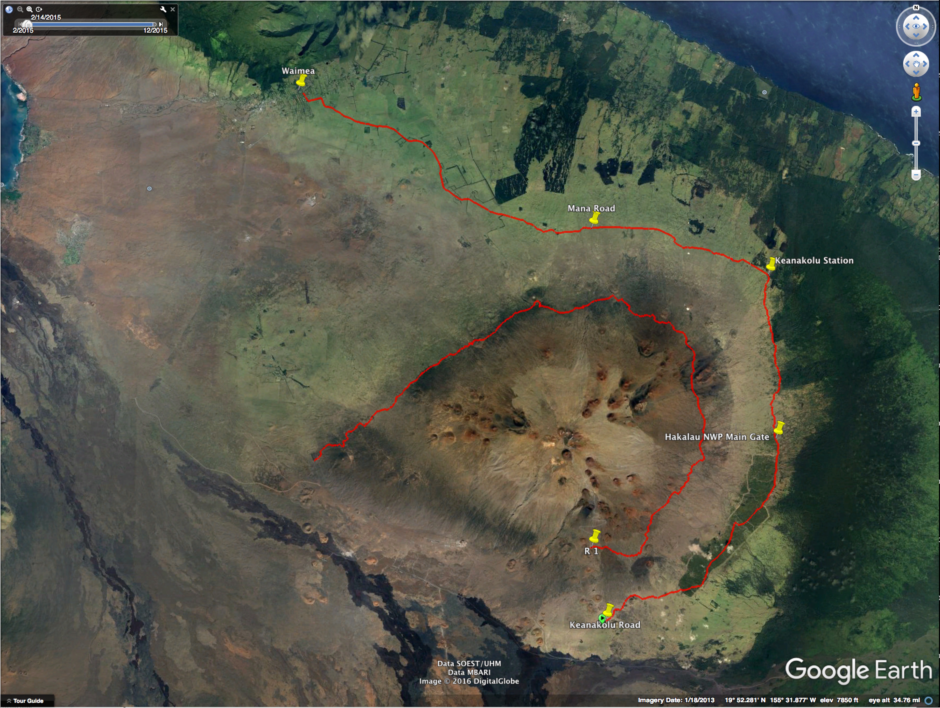
The front page map is from Google Earth.
As this site expands, there will be maps showing the novel’s important places and tracks.
{ if (window.innerWidth >= bp.minWidth) enabled = bp.enabled; });
if (!enabled) return;
const pic = $el.closest('picture');
const light = pic && pic.querySelector('source[data-lightbox-role="light"]');
const dark = pic && pic.querySelector('source[data-lightbox-role="dark"]');
$dispatch('image-lightbox-open', {
id: 'rw97103CBE_1AAD_408B_856D_8FE83190D3B7',
src: (light && light.getAttribute('srcset')) || $el.currentSrc || $el.src,
srcDark: (dark && dark.getAttribute('srcset')) || null,
alt: $el.alt,
});
" decoding="async" />
Here’s a Google Earth image showing two tracks that figure importantly in the novel.
At one point, Max and June hike the road R-1, about 36 high-altitude miles on Mauna Kea.
Another important scene happens along Keanakolu Road, not far from the Hakalau National Wildlife Preserve.